BG Subway Second Line Route Extended to New Bezanija Cemetery – Tender for Preparation of Digital Topographic Plan Opens
Source: eKapija
 Monday, 28.06.2021.
 14:12
14:12
 Monday, 28.06.2021.
 14:12
14:12
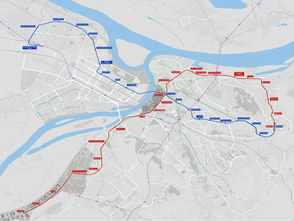
Previous route of line 2, with the final stop at Zemun Railway Station (Photo: Egis)

Compared to the previously presented plans (pictured above), then, line 2 has been extended from the Zemun Railway Station to the New Bezanija Cemetery.
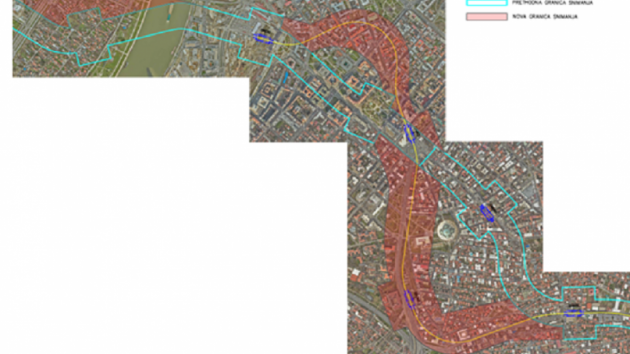
The limits of line 2 on the sections between the stations should encompass a corridor 160 meters wide, with 80 meters on each side from the axis. In the zone of the stations, the limits are expanded to 160 meters on each side from the axis, with a total length of 200 meters. As for the depot, the limits encompass an area 80 meters wider than the defined lines for the construction of the depot.
The total area covered by the borders is around 425 ha.
The service of the preparation of the digital topographic plan for the purposes of the preparation of the planning and technical documentation for line 2 includes the defining of the Vracar railway tunnel with two separate tubes. The limits of the tunnel are 80 meters to the left and 80 meters to the right from the location of the crossing of line 2 with the tunnel. The topographic surveying needs to determine the exact position of the axis and the gradient of the tunnel, as well as the proportions and the shape of the profile of the tunnel.
The surveying does not need to encompass the section of line 2 between the Sava Centar and Manjez stations. For that section, which is developed through the Preliminary Project of the First Phase of Subway Line 1, the digital topographic plan was prepared in the past period.
Bids may be submitted by July 1, 2021.
Companies:
 JKP Beogradski metro i voz Beograd
Tags:
PUE Beogradski metro i voz
preparation of Digital Topographic Plan of Belgrade Subway Line 2
Bežanija Cemetery
BG Subway line 2
construction of a subway
Belgrade Subway
Comments
Your comment
Naš izbor
Most Important News
Full information is available only to commercial users-subscribers and it is necessary to log in.
Follow the news, tenders, grants, legal regulations and reports on our portal.
Registracija na eKapiji vam omogućava pristup potpunim informacijama i dnevnom biltenu
Naš dnevni ekonomski bilten će stizati na vašu mejl adresu krajem svakog radnog dana. Bilteni su personalizovani prema interesovanjima svakog korisnika zasebno,
uz konsultacije sa našim ekspertima.


 Izdanje Srbija
 Serbische Ausgabe
 Izdanje BiH
 Izdanje Crna Gora


 News
News


